The Best Routes To See Holiday Lights Near Vancouver

Ready-optimized routes to help you visit the best Christmas light displays in the greater Vancouver metro area without spending extra time on the road.

- We used Routific's route optimization software to plan the shortest routes for seeing holiday light displays.
- To see the the most displays in the shortest time, visit Surrey and Langley.
- To see all 28 displays in the Vancouver Sun's list, choose one of three routes.
- Send a route directly to your phone (or save the link) to start driving.
Holiday light displays are a great way to combat the midwinter dark and cold, and visiting the best ones is a holiday tradition. But where are they?
The Vancouver Sun publishes a great annual list of spectacular Christmas displays. Since route optimization is what we do every day at Routific, we thought we’d make things easier by optimizing routes so that people can see all the lights they want, while driving the shortest distance.
There are 28 addresses on the list as we write this, and they’re spread out across the Lower Mainland all the way from Vancouver to Abbotsford. That’s over 200km of driving if you want to do them all at once! So we’ve created two sets of routes:
- To see the most displays in a single trip: Visit Surrey and Langley
- To see them all: We’ve created three routes you can stitch together across three trips.
From routes to driving directions
How do you actually drive these routes? We’ve set them up in Google Maps for you!
- Click the link in each section to open the route you want.
- Then click “Send directions to phone” or “Copy link” to get them on your phone. (I like to copy the link and save it to a note, so if anything goes wrong I don’t lose all the work).
Option 1: See the most displays in a single trip — Surrey and Langley
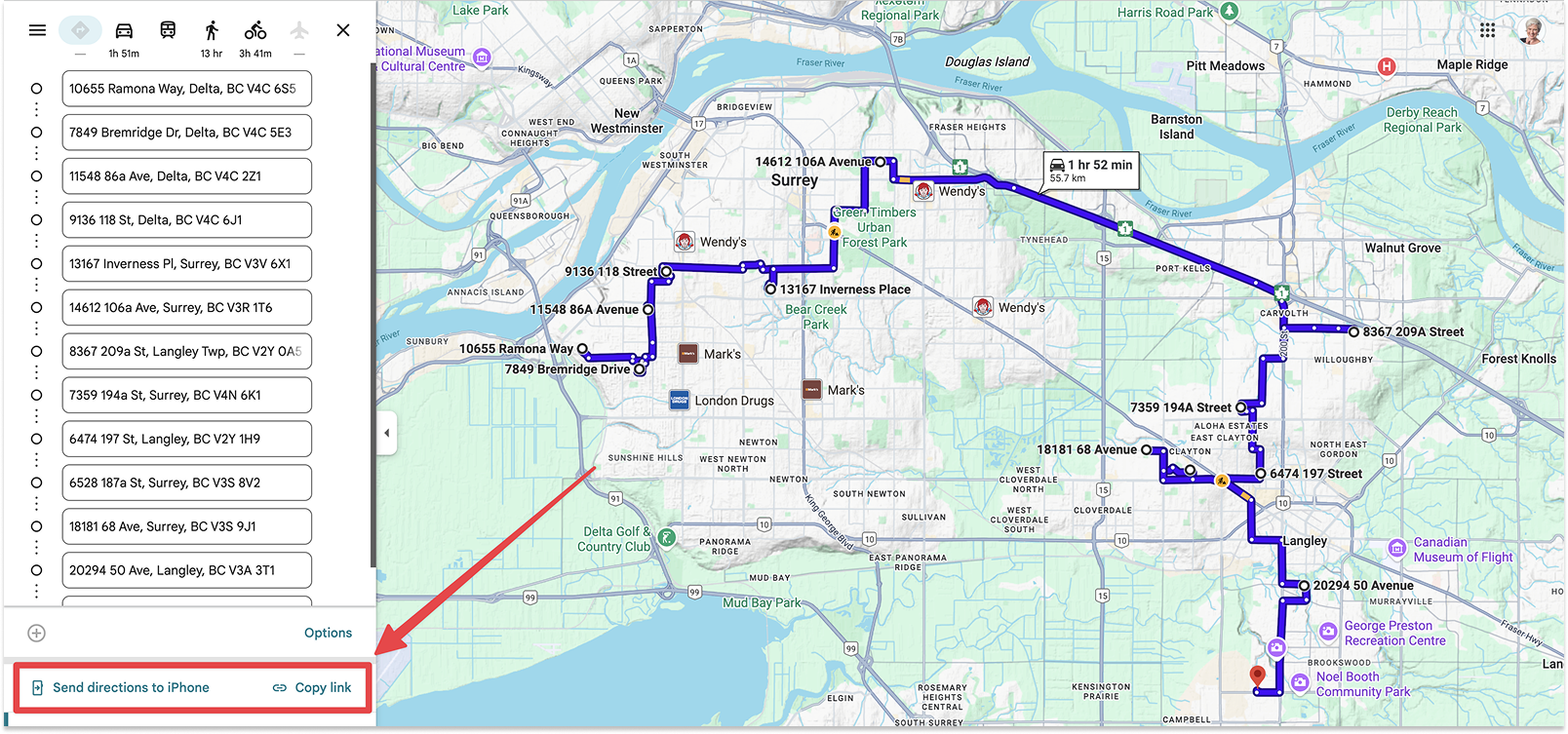
The highest density of Christmas light displays is in Surrey and Langley, so you can visit 13 of the best in around 2 hours in a single trip. Here’s the Google Maps link.
Option 2: See all the lights displays (or choose your area)
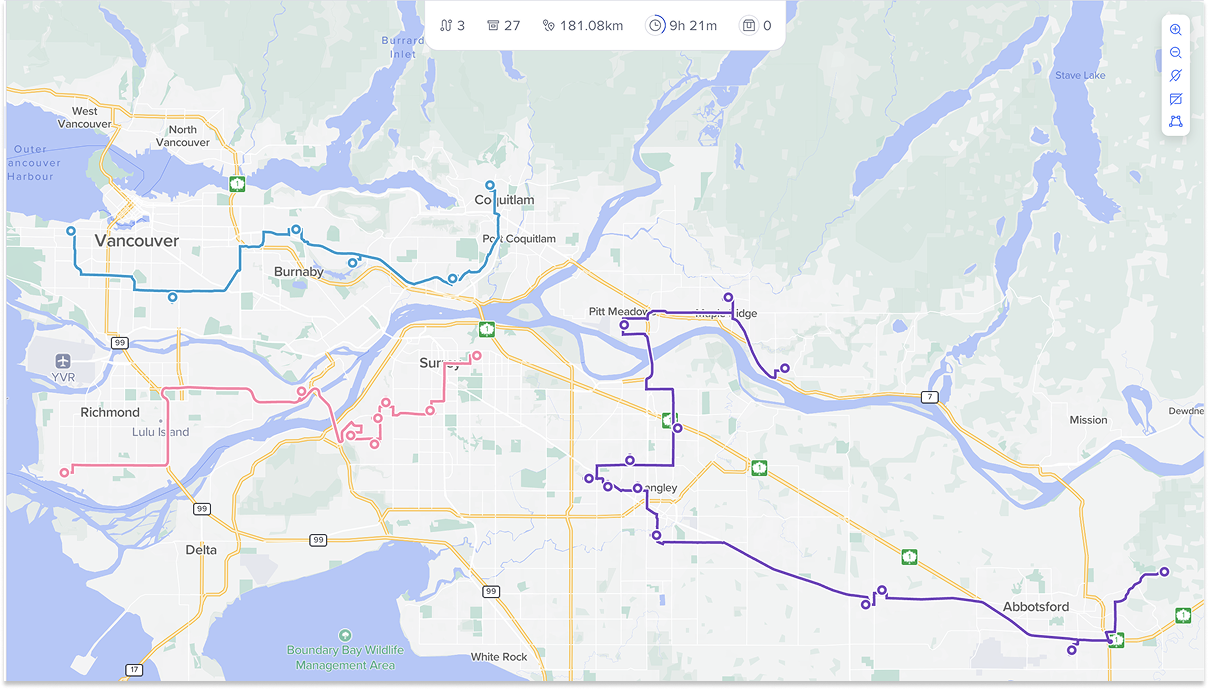
If you want to visit all 28 displays, or just want to see everything available in one compact area, we’ve created three main routes:
- Vancouver to Coquitlam
- Richmond and Surrey
- Maple Ridge though Langley, to Abbotsford
Here are all three routes on one map inside the Routific app:
And here are the Google Maps links for all three routes:
Route 1: Vancouver to Coquitlam
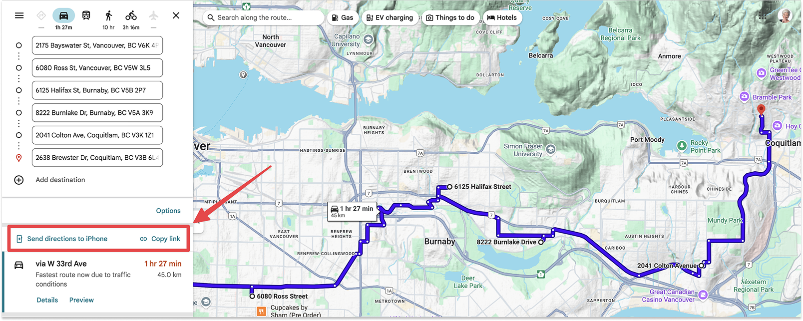
Here’s the Google Maps link. You may want to tweak this route depending on where your starting point is.
Route 2: Richmond, Delta, and Surrey
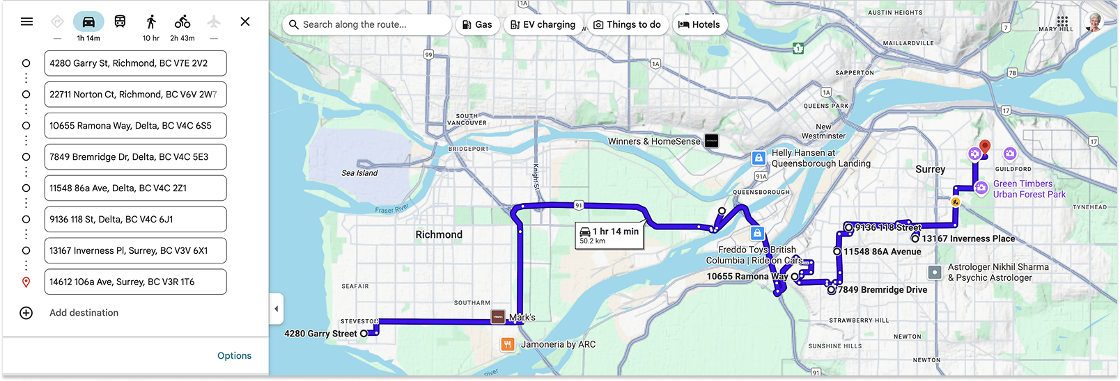
Here’s the Google Maps link. There are only two places in Richmond and it’s a long driver between them, so for the best experience I’d skip Steveston and start in Delta.
Route 3: Maple Ridge to Langley and Abbotsford
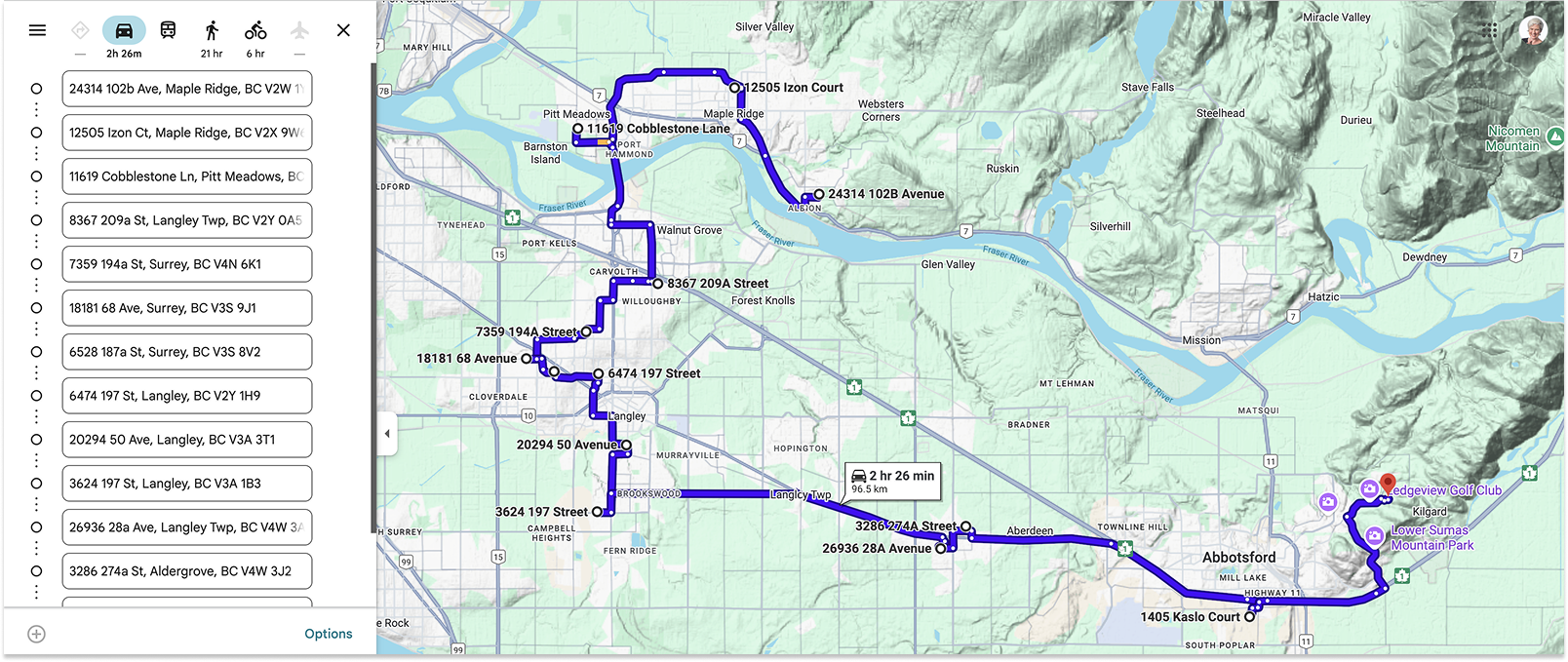
Here's the third and longest route, taking about 2-3 hours to cover the whole area from Maple Ridge through Pitt Meadows to Langley, Aldergrove, and Abbotsford.
And that’s all you need!
💡Routific is world-leading route optimization and delivery management software made in Vancouver! If you have a business that makes deliveries or needs route planning, check out our 7-day free trial.
What if I want to use a different app for driving directions?
If Google Maps is not your thing and you’d prefer an alternative like Apple Maps or Waze, you’re welcome to use our ordered stop lists. You can get them all off our spreadsheet here.
A note for the map geeks
You may have noticed that some of these routes have more than 10 stops – but Google Maps doesn’t allow adding new addresses after 10! So how did we do it?
There’s a nifty little tool called MoreThan10 that allows you to stitch multiple Google Maps routes together. It’s free and fabulous — one of those little acts of online generosity that restores our faith in humanity. Thank you, anonymous makers!
Frequently Asked Questions

Google Maps Route Planner: How To Plan Multi-Stop Routes

Route Planning Vs Route Optimization: What’s The Difference?